Unlocking Crop Insights from Space Tech: Part 1 - Data Acquistion
 Radhika Aggarwal
How Satellites See the Future of Farming?
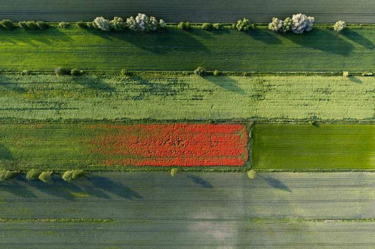
Imagine a world where farmers can predict crop yields with incredible accuracy. This isn't science fiction! Thanks to advancements in satellite technology and machine learning, we're unlocking a new era of agricultural insights from the power of space. This article explores how satellite data revolutionizes crop yield prediction, empowering farmers, researchers, and policymakers to optimize practices and ensure global food security.
Spying on Your Crops (For Good!): The Power of Remote Sensing
As a developer and tech enthusiast, you've probably heard of the incredible things being done with data. From self-driving cars to personalized recommendations, data is driving innovation across industries. But have you ever considered how data can be used to feed the world?
Remote sensing, the science of acquiring information about the Earth's surface from a distance, is revolutionizing agriculture. With satellites constantly orbiting our planet, we can now "spy" on our crops in a way that was unimaginable just a few decades ago.
How Does It Work?
Imagine a satellite equipped with high-resolution cameras, capable of capturing images of fields from hundreds of miles above. These images aren't just pretty pictures. They contain a wealth of information about the health, growth, and development of crops. By analyzing the spectral properties of the light reflected from the plants, we can extract valuable insights.
Key techniques used in remote sensing for agriculture:
Backscatter Value: This is a measure of the radar signal that is reflected back to the satellite. It can provide insights into crop structure, moisture content, and biomass.
Multispectral Imagery: Capturing images in multiple wavelengths of light to differentiate between different types of vegetation and soil conditions.
Time-Series Analysis: Tracking changes in crop growth and development over time.
Machine Learning: Using algorithms to automatically detect and classify crop features.
The Search for the Ideal Dataset
From the vast expanse of remote sensing data, Sentinel-1A emerges as a powerful tool for agricultural applications. Its unique capabilities and ability to provide consistent data regardless of weather conditions make it a valuable asset for researchers and farmers alike.
Sentinel-1A: A Powerful Tool for Agricultural Data
Sentinel-1A is a European Space Agency (ESA) satellite that offers a unique perspective on Earth's surface, making it particularly valuable for agricultural applications. Its primary instrument is a synthetic-aperture radar (SAR), which allows it to penetrate clouds and darkness, providing consistent data regardless of weather conditions.
Key Properties
| Satellite | Sentinel-1A |
| Year Launched | 2014 |
| Sensor | SAR-C |
| Organization | ESA |
| Spatial Resolution | 10m |
| Temporal Resolution | 12 days |
| Polarization | VV/VH |
## List of Contents
1. Data Acquisition
2. Data Processing
3. Data Stacking
4. Machine Learning Modelling
5. Predictive Analysis
Data Acquisition
Importing Necessary Libraries
 import asf_search as asf
 import geopandas as gpd
 import fiona, os, shutil
 from fiona.crs import to_string
ASF Search is a Python library that provides an interface to the Alaska Satellite Facility (ASF) archive, allowing users to search for and download satellite imagery. It simplifies the process of finding and acquiring data from various satellite missions, including Sentinel-1A.
Processing the Shapefile
vector_layer = gpd.read_file(path_to_shapefile) c = fiona.open(path_to_shapefile, crs = 'epsg:4326')print("Total GT polygon found in shape file:", len(list(c))) print("CRS:", to_string(c.crs)) print("Bounds:", c.bounds) print("Schema:", c.schema)layer = vector_layer.to_crs(epsg= 4326) wkt = str(layer['geometry'][0]) # well known textDefining Dates & Search Parameters
To refine our satellite data search, we'll specify parameters:
Platform: Choose the specific satellite platform (e.g., Sentinel-1A) that acquired the data.
Processing Level: Select the desired level of data processing (e.g., GRD_HD for Ground Range Detected - High Resolution).
Start & End Dates: Filter results by specifying the start and end dates of data acquisition. You can use timestamps or natural language expressions like "3 weeks ago."
Intersects With: Define the geographic area of interest using Well-Known Text (WKT) coordinates for polygons, linestrings, or points.startDate = '2024-01-01' endDate = '2024-06-30' findOrbit = asf.geo_search( platform = [asf.PLATFORM.SENTINEL1A], intersectsWith = wkt, processingLevel = 'GRD_HD', start = startDate, end = endDate, flightDirection = 'Descending')Get the Relative Orbit
 orbit = int(findOrbit[-1].geojson()['properties']['fileName'][49:55])
 print('Orbit number: ', orbit)
 x = (orbit - 73) % 175
 # defining orbit number formula to find orbit of a zip file of a particular date
 relativeOrbit = x + 1
 print('Relative Orbit number: ', relativeOrbit)
Execute Parameters for Geo Search
 results = asf.geo_search(
     platform = asf.PLATFORM.SENTINEL1,
     processingLevel = [asf.PRODUCT_TYPE.GRD_HD],
     start = startDate,
     end = endDate,
     intersectsWith = wkt,
     flightDirection ='Descending',
     relativeOrbit = relativeOrbit
     )
 print(f'Total Images Found: {len(results)}')
 print('List of files to be downloaded: ')
 for i in range(len(results)):
     print(results[i].geojson()['properties']['fileName'])
Create an ASF Session
 username = 'your_username'
 password = 'your_password'
 session = asf.ASFSession().auth_with_creds(username, password)
 # connects with Earthdata Search's portal
To download data from the ASF archive, you'll need an EarthData account. Log in using your EarthData credentials with the auth_with_creds() method. If you don't have an account, you can register for one for free. EarthData accounts are useful for downloading data from various NASA portals, including USGS EarthExplorer.
Download the satellite imagery files
Begin downloading....
 download_path = str(os.getcwd()) + r'\data\SeNtinel-1A\downloadData'
 # specify your download path
 results.download(
      path = download_path,
      session = session
   )
Advancements in satellite technology and machine learning are revolutionizing agriculture by providing precise crop yield predictions. This article explores the use of remote sensing, particularly the Sentinel-1A satellite, to gather valuable agricultural data. It covers the entire process of acquiring Sentinel-1A data using the ASF Search library.
Subscribe to my newsletter
Read articles from Radhika Aggarwal directly inside your inbox. Subscribe to the newsletter, and don't miss out.
Written by

Radhika Aggarwal
Radhika Aggarwal
Product Tech @Guardian Group | Ex-Research Intern @ISRO | AI/ML, Looker Studio, & Data Analytics | Quant Research & Development