About Land Survey
 Irene Mulondu
As we approach the Global Surveyors Day, on 21st March, I feel the need to write about Land Survey given that it is something close to my heart. I am a Geomatic and Geospatial Engineer, (what a mouthful😂!) which Land Survey is part of what I do. Maybe one day I will write about Geomatic and Geospatial Engineering.
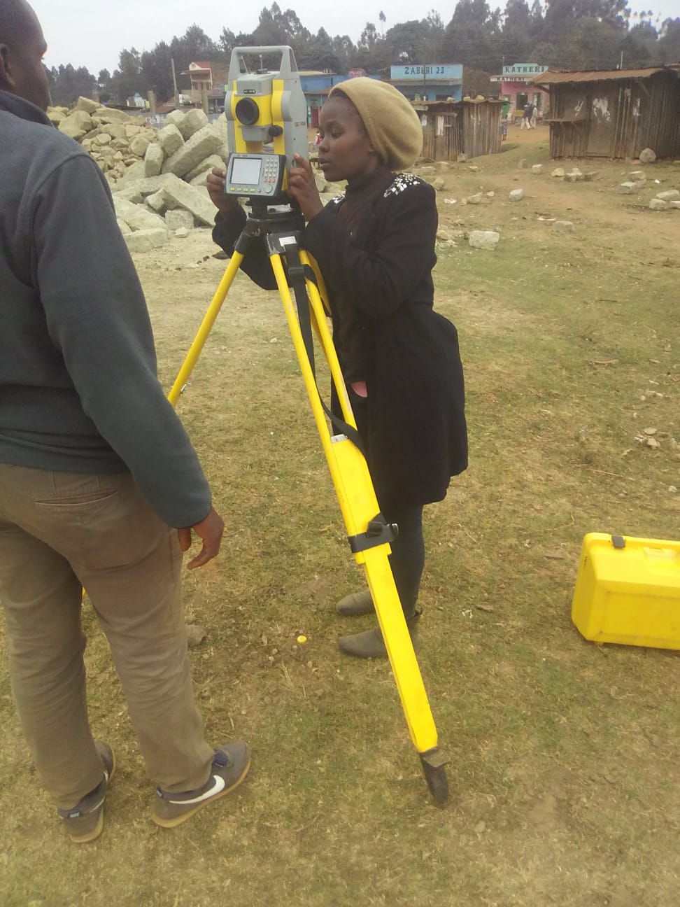
Setting out a total station, so as to start surveying.
So Land Surveying involves measuring and mapping land features to determine boundaries, elevations, and land characteristics.
History of Surveys
One of my first land survey classes, at Jomo Kenyatta University of Agriculture and Technology, was about history of survey. There I was eager to hear from the lecturer how survey began. I was struck when she started with …”did you know the first surveyor is God! It’s all in the Bible, the book of Genesis, in the story of creation…” Survey is one of the oldest professions.
The practice of surveying dates back to ancient civilizations, where early societies used rudimentary tools to measure land for agricultural and construction purposes. Some key historical developments include:
Ancient Egypt (around 3000 BC): Egyptians used rope stretchers and simple geometry to mark land boundaries, particularly for rebuilding after the annual flooding of the Nile River.
Roman Empire (500 BC – 476 AD): Romans developed more sophisticated surveying techniques to build roads. Which some are in existent today and we even have a wise famous saying "All roads lead to Rome" which is a proverb of medieval origin, referring to the extensive network of Roman roads that connected the capital to all parts of the empire.
Medieval Europe: Land surveying became crucial for taxation and land ownership records. The Domesday Book (1086), which is a manuscript record of the Great Survey of much of England and parts of Wales completed in 1086 at the behest of King William the Conqueror was an early example of systematic land recording.
18th and 19th Century Developments: The advent of more precise instruments, such as the theodolite and total station, improved the accuracy of land surveys.
Modern Era: The introduction of digital technology, GPS (Global Positioning System), and remote sensing has transformed surveying into a highly accurate and efficient practice.
Methods of Surveying
Surveys can be classified based on their purpose, the methods used, and the equipment involved. The main types of surveys include:
a) Land Surveying
Land surveying is the process of determining and mapping land boundaries. The main types include:
Cadastral Surveying: Used to establish legal land ownership and property boundaries.
Topographic Surveying: Maps the natural and man-made features of an area, including elevation and landscape details.
Engineering Surveying: Supports the planning and construction of infrastructure like roads, bridges, and buildings.
b) Geodetic Surveying
This method involves measuring large areas of the Earth's surface using high-precision instruments and satellite technology. It accounts for the Earth's curvature and is used in mapping national and international boundaries.
c) Hydrographic Surveying
This survey method maps underwater features such as riverbeds, sea floors, and oceanic formations. It is essential for marine navigation and infrastructure development like ports and bridges.
d) Aerial and Remote Sensing Surveys
These methods use aircraft, drones, and satellites to collect survey data. Technologies like LiDAR (Light Detection and Ranging) and photogrammetry are commonly used to generate detailed 3D maps and elevation models.
e) GIS (Geographic Information System) Surveys
GIS integrates survey data with digital mapping systems to analyze spatial relationships. This method is used in urban planning, environmental management, and resource allocation.
Legal Framework Governing Surveying in Kenya
Surveying in Kenya is governed by various laws and regulations to ensure accurate land measurement, property ownership, and dispute resolution. The key legal frameworks include:
a) The Constitution of Kenya (2010)
Provides the legal foundation for land ownership and management.
Defines the classification of land into public, private, and community land.
b) The Land Act (2012)
Regulates land administration and management.
Provides guidelines for land ownership, leasing, and compulsory acquisition.
c) The Survey Act (Cap 299)
Governs land surveying and mapping in Kenya.
Establishes the Director of Surveys, who is responsible for maintaining survey records and standards.
Provides regulations on cadastral and geodetic surveys.
d) The Physical and Land Use Planning Act (2019)
Provides for the regulation of land use and spatial planning.
Ensures that surveys align with urban and rural development plans.
e) The Land Registration Act (2012)
Governs the process of registering land ownership and transfers.
Requires proper surveys before land titles can be issued.
f) The National Land Commission Act (2012)
Establishes the National Land Commission (NLC) to manage public land and resolve disputes.
Ensures compliance with survey regulations in land allocation and acquisition.
The Institution of Surveyors of Kenya (ISK)
The Institution of Surveyors of Kenya (ISK) is a professional body that regulates and promotes the surveying profession in Kenya. It was established to:
Set ethical and professional standards for surveyors.
Provide training, accreditation, and licensing for surveyors.
Advocate for the rights and interests of surveyors.
Ensure compliance with government regulations and international best practices.
ISK has different professional chapters, including:
Land Surveying Chapter: Focuses on cadastral and geodetic surveying.
Valuation Chapter: Deals with property valuation.
Estate Agency Chapter: Deals with property and real estate management.
Building Surveyors Chapter: Covers structural inspections and property development.
Geospatial Information Management Surveyors Chapter: Specializes in GIS and remote sensing.
Land Administration Managers Chapter: Deals with land management.
Engineering Surveyors Chapter: Supports infrastructure projects through precision surveys.
Conclusion
Surveying is an essential profession that underpins land management, construction, and development in Kenya. With historical roots dating back thousands of years, the practice has evolved to incorporate advanced technologies like GIS and remote sensing.
In Kenya, surveying is governed by strict legal frameworks such as the Survey Act and the Land Act, ensuring accurate land measurement and dispute resolution.
The Institution of Surveyors of Kenya (ISK) plays a crucial role in maintaining professional standards, ensuring ethical practices, and advancing the profession for sustainable development.
References
Bannister, A., Raymond, S., & Baker, R. (1998). Surveying (7th ed.). Pearson Education.
Ghilani, C. D., & Wolf, P. R. (2017). Elementary Surveying: An Introduction to Geomatics (15th ed.). Pearson.
Subscribe to my newsletter
Read articles from Irene Mulondu directly inside your inbox. Subscribe to the newsletter, and don't miss out.
Written by
Irene Mulondu
Irene Mulondu
I am a GIS enthusiast. Mostly what I do is make maps, create and manage GIS softwares and I Iove R and am learning to appreciate Python. So mainly am a learner in GIS and programming and I like to explore integration of various programming algorithms with GIS.