GISBox conversion: 3DTiles → OSGB in one step
 GISBox
GISBox Official Teams: https://teams.live.com/l/invite/FEAr12sInvEVy4hFQE
Official Teams Group: https://teams.live.com/l/invite/FBAFp0pbqhqlpe1BQI
Contact us to get 7-day Team Plan
In the field of 3D geographic information system (3D GIS) and digital twins, 3DTiles and OSGB are two widely used 3D model formats. 3DTiles, as an open standard developed by the Cesium team, is particularly suitable for the visualization of massive 3D data in a network environment; while OSGB (OpenSceneGraph Binary) is a high-performance format commonly used in localized 3D applications. This article will introduce in detail how to use GISBox, a professional tool, to achieve efficient conversion between 3DTiles and OSGB formats to meet the needs of different application scenarios.
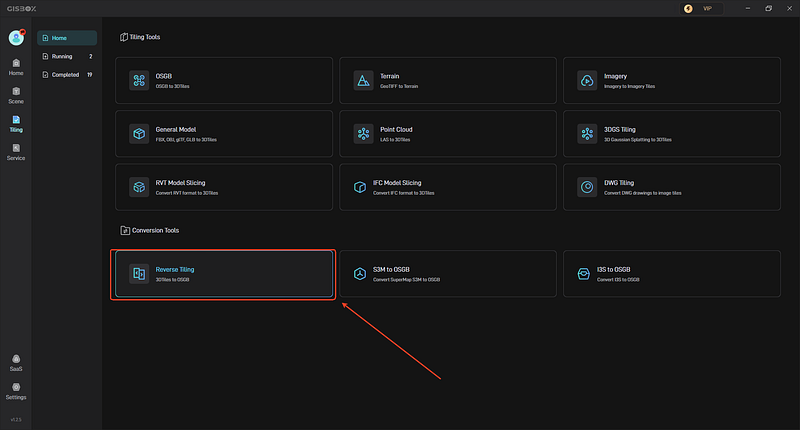
1. Create a new tiling task
Open the GISBox software, in the “Tiling”, Select “Reverse Tiling ” to create a tilng task.
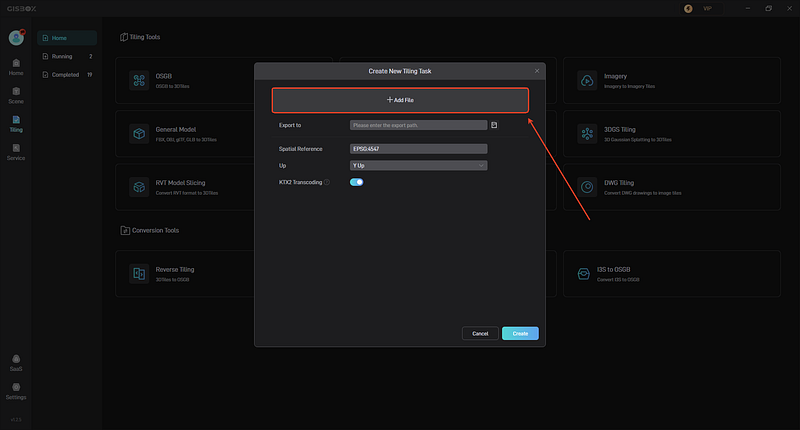
2. Add file
In the pop-up “Create New Tiling Task” window, click the “+ Add File” button above to add our local file, usually a tileset.json file.
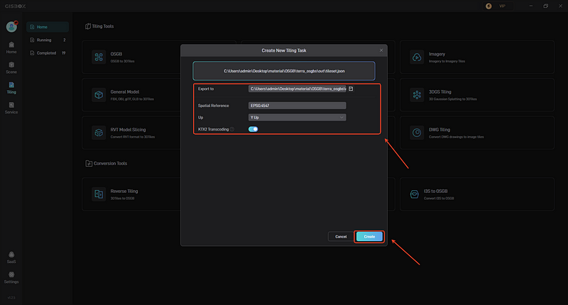
3. Set parameters and start tiling
After adding the file, you can set the folder path for tile export. You can choose to turn on the “KTX2 Transcoding”, and set up spatial reference, choose “Y up” or “Z up”. Then click “Create”.
Subscribe to my newsletter
Read articles from GISBox directly inside your inbox. Subscribe to the newsletter, and don't miss out.
Written by
GISBox
GISBox
Free Local Server · Free Self-Hosted · Offline Data For Cesium Unity GISBox is a geographic information system (GIS) software. GISBox offers tools for editing, converting, and publishing geospatial imagery, terrain data, and 3D models.