Digital twin compatible! I tried out GISBox's smart compression
 GISBox
Free on-premise cesium ion alternative
GISBox’s “Rebuild Top Level” function is a lightweight processing technology specialized for large-scale oblique photo models (such as OSGB format). It aims to speed up the loading of huge 3D city models while balancing visualization quality and data accuracy.
■ 1. Function positioning: Resolves the problem of loading ultra-large models
OSGB models covering entire cities can contain tile data of up to billions of files, and conventional processing creates the following problems:
Performance limitations: PCs and smart devices cannot process them, causing freezing and crashing.
Display delays: Hierarchical rendering is slow, resulting in a poor user experience.
GISBox’s “Rebuild Top Level” function optimizes the model hierarchy to generate a simplified top-level model.
This allows
Display in seconds: Even tens of GB of data can be rendered smoothly.
Comfortable operability: Rotation, zoom, pan, and other operations are possible in real time.
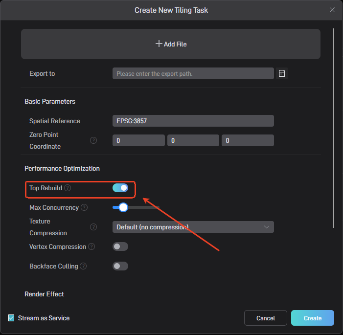
■ 2. Technical approach: Hierarchy optimization and data weight reduction
Hierarchy simplification: Only the important two levels are kept, and the intermediate layers are reduced to compress the overall capacity.
Topology reconstruction: Duplicate geometry and textures are integrated to maximize drawing efficiency.
Smart compression:
Vertex compression reduces weight while maintaining accuracy.
High-performance texture compression using the KTX2 format achieves high-speed display.
■ 3. Use cases: Suitable for a variety of 3D space uses
Digital twin city: Supports smooth operation on the web and mobile devices in the visualization of urban traffic and redevelopment.
GIS engine linkage: Export possible in 3DTiles or Terrain format, and seamless integration with Cesium and Mapbox.
Multi-data fusion: Automatic matching with topographical information (DEM) makes simultaneous display with other data layers smoother.
In conclusion, GISBox’s “top reconstruction” function is an “engine” that takes 3D data utilization to the next stage. It reduces the weight of huge oblique photography models while enabling wide-area deployment, high-speed operation, and merging with other layers, making it an essential solution for urban visualization and infrastructure management.
GISBox Official Teams: https://teams.live.com/l/invite/FEAr12sInvEVy4hFQE
Official Teams Group: https://teams.live.com/l/invite/FBAFp0pbqhqlpe1BQI
Contact us to get 7-day Team Plan
Subscribe to my newsletter
Read articles from GISBox directly inside your inbox. Subscribe to the newsletter, and don't miss out.
Written by
GISBox
GISBox
Free Local Server · Free Self-Hosted · Offline Data For Cesium Unity GISBox is a geographic information system (GIS) software. GISBox offers tools for editing, converting, and publishing geospatial imagery, terrain data, and 3D models.